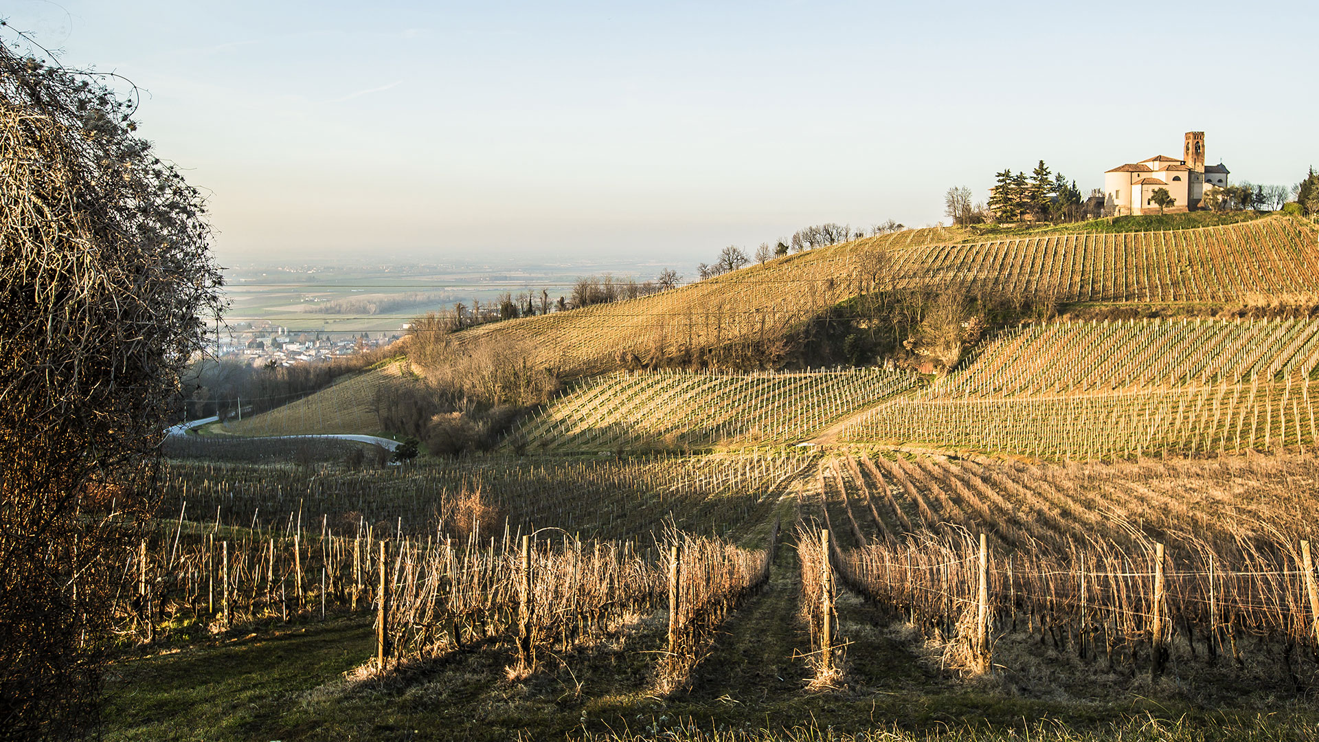
Trails among the vineyards around Santa Giuletta

Walk · ride · plan your return

Set off from here. Choose how to return.

Marked loops, linear trails and ancient routes meet around Santa Giuletta. Each adventure deserves a return plan before setting out.

At a glance

Marked local routes
315, 315A and 315B
Long-distance route
Via Postumia
Suitable for
Walking, MTB, gravel and e-bike
Important
Check surfaces, weather, access and return plan

Sentieri Uniti

Three marked routes begin or pass through Santa Giuletta.

The Sentieri Uniti network links eight Oltrepò municipalities with around fifty kilometres of white-and-red marked routes for walkers, cyclists and horse riders.

The 315A and 315B are genuine loops; the 315 continues one way to Lirio. The Via Postumia also offers westbound stages with a possible rail return. These are not protected cycle paths: surfaces and gradients vary, so suitable footwear and off-road tyres are important.

Open the official map of routes 315, 315A and 315B (PDF) ↗

From the inn and back

Choose your loop.

Published distances refer to the complete marked loops. Always check weather, trail signs, agricultural activity and temporary closures before leaving.

315A

Hiking · MTB · gravel · e-bike

The hillside loop

19.4 km · +603 m · about 6 hours on foot

A mixed-surface loop through Torricella Verzate, Oliva Gessi, Mornico Losana and Santa Giuletta. It reaches the Santa Giuletta castle area, so guests can join the marked network near the inn and return to the same point.

Rolling terrain, dirt tracks and rural roads require some fitness. A section near the end may cross private property; if it is closed, use the signed road alternative and check conditions locally.

Read the route source ↗
315B

Hiking · MTB · gravel · e-bike

The vineyard loop

About 16 km · +462 m · about 4 h 40 min on foot

A shorter ring joining Cigognola, Pietra de’ Giorgi, Redavalle and Santa Giuletta. Vineyards, castles, farm tracks and secondary roads make it the most direct full-day loop to begin and end in the village.

The surface alternates between asphalt, white roads and dirt. Follow the white-and-red CAI/Sentieri Uniti signs and ask at the inn for the latest access point before setting out.

Read the route source ↗

One way, with a return plan

Linear routes.

Distances are approximate and do not include unplanned detours. Book any taxi or pick-up before leaving and recheck the current train or trail information on the same day.

315

Hiking · MTB · gravel · e-bike

Santa Giuletta to Lirio

10.8 km one way · +374 m / −179 m · about 3 h 15 min

The only linear route in the Sentieri Uniti network starts from Via Martiri della Libertà in Santa Giuletta and crosses the hills to Lirio on mixed surfaces and marked paths.

Return plan

There is no railway station in Lirio. Either retrace the route (21.6 km and about 6½ hours in total), leave a second car there, or pre-book a taxi or private pick-up. Do not rely on finding transport after arrival.

The published figures refer to the marked route from Santa Giuletta, not to any extra connection from the inn. Check signs, agricultural work and surface conditions locally.

VP · C

Hiking · MTB · gravel · e-bike

Via Postumia to Casteggio

About 8 km · about 2–2½ hours on foot

Follow the official Via Postumia westwards through vineyard roads and the first Oltrepò hills to Casteggio, the Roman Clastidium. The estimate is measured from the inn on the current official GPX, including the short link to the railway station.

Return plan

Recommended return: regional train from Casteggio to S.Giuletta. From S.Giuletta station there are about 2.8 uphill road kilometres back to the inn: arrange a taxi or pick-up in advance, or allow for this final walk. Check the exact train on the day.

Not every service calls at S.Giuletta. Cyclists must select a train that displays bicycle admission; standard bicycles cannot travel on replacement buses.

VP · V

Experienced hikers · MTB · gravel · e-bike

Via Postumia to Voghera

About 29 km · full day

A demanding continuation of the same westbound route reaches Casteggio, Torrazzetta, Codevilla and finally Voghera. It is a genuine linear day stage, best suited to trained walkers or off-road cyclists.

Return plan

Return by regional train from Voghera towards S.Giuletta; the chosen service may be direct or may require a change. Then plan the final 2.8 uphill road kilometres to the inn by pre-booked taxi, pick-up or on foot.

Start only after checking the current GPX, daylight, weather and return timetable. For bicycles, verify the bicycle symbol on the individual train before departure.

An ancient line across Europe

700 Enolocanda is on the Via Postumia.

The modern walking and cycling route follows the memory of the Roman road from Aquileia to Genoa and joins the European ways towards Santiago de Compostela.

In Oltrepò it crosses the Santa Giuletta and Casteggio area. The inn is a natural place to pause along the route: a meal, a tasting, a quiet room and the chance to set off again among the vineyards the next morning.

Before setting out.

Trail surfaces and access can change after rain, maintenance or agricultural work. The information on this page is for trip planning, not live navigation. Carry water, use the current official track, respect private property and ask us about the latest local conditions.

Clear answers

Frequently asked questions.

Which routes pass through Santa Giuletta?

The area is crossed by routes 315, 315A and 315B of the Sentieri Uniti network and by the Via Postumia. This page explains loops, linear stages and return options.

Do the routes begin at the inn?

The network crosses the Santa Giuletta area and can be joined via local connectors. Read the access notes alongside published distances and confirm the current joining point locally.

Are the routes suitable for every bicycle?

No. Surfaces include asphalt, gravel roads and dirt tracks; MTB, gravel bikes or e-bikes with suitable tyres are recommended. Weather, farm work and access may change.

Call WhatsApp Book